You can be a penguin detective and contribute directly to MAPPPD
Over the last several years, penguin biologists have been working hard to find all the penguin colonies in Antarctica using satellite imagery. However, the massive expanse of the continent and the challenges of finding each last penguin colony leave many likely undiscovered. This is where you can help! This short guide is intended to walk you through the basics of penguin colony detective work using Google Earth. Understanding what you are seeing in satellite imagery takes some practice, but with some patience, you too can join the online expedition to find all of Antarctica's penguins.
Follow the steps below: |
|---|
| Step 1 |
|
Download Google Earth or Google Earth Pro at https://www.google.com/earth/. Google Earth Pro is now free, and contains additional features that users may find useful. |
| Step 2 |
|
Download the .kml files for all sites per each species by clicking on the appropriate button seen here. Double click the file to open in Google Earth when downloaded. When opened they will help you identify existing colonies. These data will be updated periodically depending on any changes to MAPPPD including site location name changes, or re-adjustment of colony locations. Check in every so often to get updated colony locations. |
| Step 3 |
|
Using the .KML files you downloaded in step 2, explore some of the known penguin colonies in Google Earth.
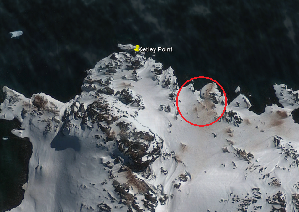
This will help orient you to what a colony should look like! You can see some images here.
If you can't find the colony, try using the time slider
to find a clearer image. Bigger colonies will be much easier to spot than smaller ones. |
| Step 4 |
|
Now that you've identified a potential candidate location, ask yourself a few questions:
If you think that you have found a site we've missed, send an e-mail to [email protected] with the following information:
|


